Two winter storms forecast to bring heavy mountain snow and rain to the Pacific Northwest
26/01/07
Farhad Banizamanlari
Two winter storms forecast to bring heavy mountain snow and rain to the Pacific Northwest
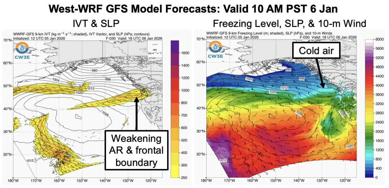
Two frontal systems are forecast to bring widespread precipitation and heavy mountain snow to the Pacific Northwest between Tuesday and Thursday, January 6 and 8, 2026. The first, associated with a weakening atmospheric river, will bring rainfall to the region on Tuesday, followed by a second, stronger system on Wednesday and Thursday, January 7–8. Snowfall totals of 30–120 cm (12–48 inches) are expected across the Cascades and Olympic Mountains, with locally higher amounts above 1 500 m (5 000 feet).
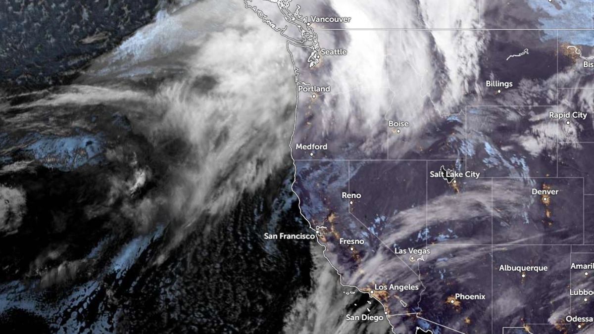
Satellite image of the U.S. West Coast at 12:00 UTC on January 6, 2025. Credit: NOAA/GOES-19, Zoom Earth, The Watchers
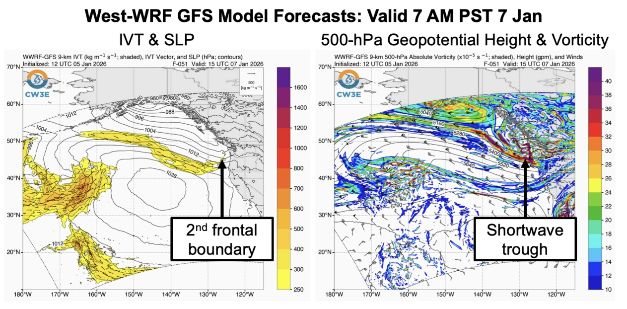
Two storms will move across the Pacific Northwest this week, producing widespread rain at lower elevations and heavy snow in the mountains. The first storm associated with a weakeningatmospheric river (AR)and frontal boundary will bring moderate rainfall and snow to western Washington and Oregon on Tuesday, followed by a colder, more active front on Wednesday and Thursday. The second system, linked to a potent mid-level shortwave trough, is forecast to enhance precipitation intensity and lower freezing levels across the region. Freezing levels below 1 200 m (4 000 feet) in the Washington Cascades, potentially dropping under 600 m (2 000 feet) during the later phase of the event.
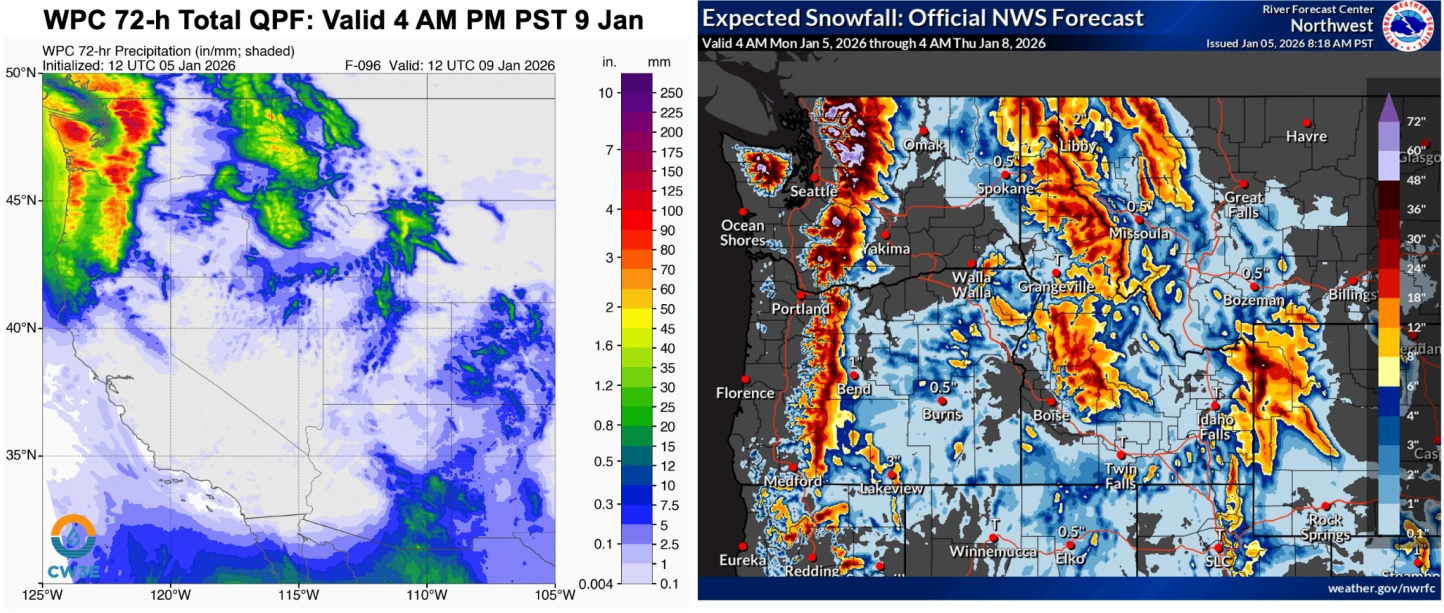
Image credit: NWS/WPC
Precipitation totals due to both storms are forecast to reach 75–150 mm (3–6 inches) in the Olympic Mountains and Washington Cascades, and 50–100 mm (2–4 inches) in the Willapa Hills, northern Oregon Coast Range, and Oregon Cascades. Snowfall totals of 30–90 cm (12–36 inches) are forecast in the Oregon Cascades, and 60–120 cm (24–48 inches) in the Olympic Mountains and Washington Cascades, with higher localized totals above 1 500 m (5 000 feet).
Image credit: CW3E
According to theCenter for Western Weather and Water Extremes (CW3E), there is about a 65% probability of at least 90 cm (36 inches) of total snowfall at Snoqualmie Pass by 04:00 PST (12:00 UTC) on January 9. The National Weather Service’s (NWS) Winter Storm Severity Index indicates moderate to major impacts due to a combination of heavy snow and gusty winds across the Cascade Range.
Image credit: NWS/WPC
These systems will contribute beneficially to the regional snowpack, which remains below normal for early January, particularly across the Oregon and southern Washington Cascades. As of January 5, snow water equivalent was 20–40% of the 1991–2020 average in much of Oregon, and 40–70% across central and northern Washington.